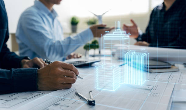
Virtual Design and Construction: Revolutionizing the Construction Industry
In present day fast -paced creation global, the need for innovation is greater than ever. Virtual Design and Construction (VDC) is presently one of the maximum reworking technologies that reflects structure, engineering and creation (AEC) enterprise. By integrating the digital equipment and superior features, VDC provides a more efficient, cost -effective and cooperative approach to dealing with construction projects.
What is virtual design and creation (VDC)?
Virtual Design and Construction (VDC) is the integration of numerous virtual technologies to grow the plan, design, production and running levels in a creation assignment. The VDC production information uses advanced gear which includes modeling (BIM), simulation software program and challenge control systems to create greater snug and certain virtual illustration of the project before the construction begins. The cause of this approach is to improve cooperation, lessen the chance and make certain that the development method is green and accurate.
Why VDC is important for modern construction projects
1. Improved Collaboration
One of the principal benefits of VDC is the opportunity to deliver different stakeholders (architects, engineers, contractors, and many others.) at the identical time inside the design segment. 3D models and simulation teams let the teams present potential problems and discuss them before physical work begins. This leads to minor changes during construction and reduces expensive errors. Everyone involved in the project is on the same page from the beginning.
2. Better visualization
Using BIM and other digital design tools, Virtual design and construction stakeholders make the entire project imagine before they are physically produced. Whether it is a 3D model or virtual review, these visualizations make more informed decisions. For example, a customer may experience a virtual tour of his future building, making it easier to change the design to fit the requirements before construction starts.
3. Cost and time efficiency
Using accurate data and digital tools, VDC helps identify potential problems in design and planning stages, which reduces expensive and delays. For contractors, this means less surprise on site, better project deadline and more accurate budget. With potential problems and adaptation of project work flow, projects are more likely to live within the scope and budget.
4. Extended risk management
Virtual models allow for better risk analysis and management. By simulating construction processes and potential challenges, VDCs can identify problems such as design errors, plan conflicts or lack of material before actual problems. In addition, it helps to understand environmental conditions and security risks, and ensure a safe work environment.
5. Stability and efficiency
VDC is also a powerful tool to ensure sustainable construction practices. Through energy modeling and simulation, project groups can analyze the energy efficiency of design, evaluate environmental impact and incorporate green building solutions that reduce carbon footprints. From the beginning, this ability to simulate and optimize the performance of materials and systems provides more sustainable construction practices.
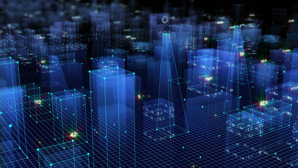
VDC Work flow: a step-by-step guide
1. Pre-design phase
At this stage, stakeholders in the project come together to discuss project goals, budget and scope. Tools such as BIM are introduced and the team begins to produce a digital model of the project. Virtual Reality (VR) and Augmented Reality (AR) Tools can be used to present the first design concepts, which gives the client a more specific idea of what the project will be displayed.
2. Design and development phase
The design phase develops digital models with detailed images and plans. The model is processed with input from engineers, contractors and other stakeholders to ensure that all details are addressed. In this phase, simulation is used to check structural integrity, physical performance and integration of building systems. With all this information, the changes can be simple and fast, and prevent problems later, and prevent problems.
3. Construction Phase
During the construction, the digital model continues to guide and inform the project group. Contractors use models to manage workplaces, track materials and determine on site. VDC tools provide real -time updates and help everyone to be informed of progress and any changes. This phase benefits from a constant response loop between model and construction, enabling fast adjustment and maintaining the project control.
4. Operation and maintenance
After the construction phase, the VDC bus does not stop. The virtual model can serve as a reference for ongoing building operations and maintenance. Building owners and convenience managers can use models for everything from regular maintenance to future renewal or upgrading. With accurate data and records, it is more effective to monitor the building’s system and performance.
VDC’s future: Trends and innovation
1. Artificial Intelligence (AI) and machine learning
As VDC keeps expanding, artificial intelligence (AI) and gadget gaining knowledge are predicted to play a primary position in future modeling, chance control and edition. The AI algorithm will help the design team make smart decisions, identify potential risks and further improve construction efficiency.
2. Cloud -based cooperation
Shooting technology improves cooperation by letting teams reach the most updated information in real time. Whether it is design updates, construction programs or budget changes, cloud -based platforms ensure that each stakeholder works from the same, the current dataset. It also improves flexibility, which means nothing to the teams where they are located.
3. Integrated project distribution
Virtual design and construction is a contract strategy moving towards Integrated Project Distribution (IPD), including a shared responsibility for the first collaboration and success of the project among all stakeholders. IPD promotes better communication, openness and coordination at all stages of a project, which fully matches VDC purposes.
Conclusion
Virtual design and construction are not only a passing tendency, but a paradigm change that helps to change the AEC industry for better. By enabling better cooperation, cost savings and improved views, VDC is designed to change the way the design, construction and operation of the buildings. For companies that use and invest in these technologies, the benefits are obvious – VDC represents a more intelligent, skilled and durable future for the construction industry. As technology develops, there is no doubt that VDC will play a rapidly integrated role in designing the future of construction.
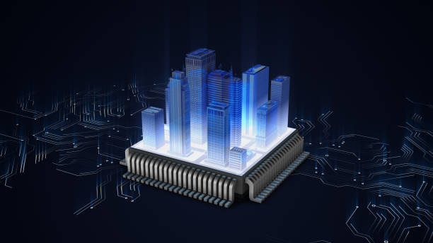
Digital Twin Technology in Construction: The Future of Building Design and Management
The construction industry is embracing digital transformation at an exceptional pace, and one of the most exciting improvements main this modification is Digital Twin Technology in construction. From designing and constructing buildings to coping with their ongoing operations, digital twins offer an effective device that complements decision-making, will increase efficiency, and improves sustainability. But what precisely is a virtual dual, and the way is it reshaping the destiny of production? Let’s discover.
What is a Digital Twin?
A digital twin is a digital sign that refers to a physical object, device, or method. Operationally, the digital twin is a deep, interactive 3D model of a building or infrastructure-related project that continuously generates new real-time computations from sensors, IoT devices, and other components.
Think of it as a resident blueprint—one that is not just the initial plan but evolves as it progresses or even after the plan ends.
How Digital Twin Technology is Changing Construction
1. Optimizing the Design and Planning Process
The design phase of a creation challenge sets the tone for the entirety that follows. With digital twin technology in Construction, designers and engineers can create noticeably unique, interactive 3-D fashions of the constructing before construction begins. These fashions offer a complete view of the structure, incorporating architectural info, engineering specifications, and even actual-global situations like environmental elements or structural loads.
Using Digital Twin Technology in construction, groups can run simulations and stress tests to see how the building will carry out underneath numerous situations, supporting perceive capacity layout flaws before any physical work begins. This now not handiest quickens the layout procedure but also minimizes the risk of errors, transform, and high-priced revisions as soon as construction is underway.
2. Enhancing Real-Time Project Management
Managing a production assignment isn’t any small feat. With countless responsibilities, stakeholders, and substances to coordinate, it’s easy for delays or miscommunications to derail the assignment. Digital twin generation permits construction managers to display every element of the construct in real time, from materials and gadget to exertions productivity.
By integrating sensors and IoT devices into the construction site, a virtual dual can provide non-stop information on progress, allowing undertaking managers to tune whether the assignment is on agenda, inside budget, and aligned with the design. This real-time feedback facilitates discover issues early, allowing quicker changes and decreasing the probability of luxurious delays or errors.
3. Predictive Maintenance and Long-Term Building Management
Once a building is finished, its management becomes just as crucial as its production. Digital twins offer excellent value in the operational phase of a building by means of imparting ongoing tracking and renovation insights. With sensors embedded within the shape, virtual twins can music the overall performance of structures consisting of HVAC, electric, plumbing, and lights in actual time.
This non-stop tracking allows constructing managers to anticipate while device will want upkeep or replacements, providing predictive protection abilities. By addressing problems before they amplify into major disasters, digital twins can make bigger the life of constructing systems and reduce long-time period renovation prices.
Additionally, facility managers can use the statistics from the virtual dual to optimize the building’s electricity intake, improving efficiency and sustainability. For example, the device might alert managers to inefficient HVAC settings, or help optimize lighting fixtures schedules based totally on occupancy styles, in the long run lowering power cost.
4. Boosting Collaboration Across Teams
In any huge-scale creation assignment, coordination between multiple teams—architects, engineers, contractors, and clients—is crucial. Digital twins provide a significant, shared version that each one stakeholder can access and engage with in real time. This guarantees that everyone is operating with the equal records, helping to save you misunderstandings, conflicts, or miscommunications.
With actual-time updates and easy access to records, teams can collaborate greater effectively, make choices quicker, and resolve troubles earlier than they become fundamental problems. For example, if there’s a warfare between the structural design and the electric format, the digital dual can spotlight the discrepancy, allowing the team to solve it earlier than construction starts off evolved.
5. Sustainability and Environmental Impact
As sustainability will become a developing difficulty inside the production industry, virtual twins are playing an essential function in supporting homes reap extra energy efficiency and reduce their carbon footprint. By simulating the building’s power use below exceptional eventualities, digital twins assist architects and engineer’s layout systems which are optimized for power efficiency and sustainability.
Once the constructing is operational, the virtual dual continues to offer precious insights into power intake, water usage, and waste management. This information can help building owners become aware of areas for development, which include adjusting heating and cooling systems to reduce power consumption or figuring out leaks which can result in water waste.
The Future of Digital Twin Technology in Construction
As the development industry keeps to include virtual innovation, the function of digital twins will only continue to grow. The integration of emerging technology like synthetic intelligence (AI), machine mastering, and augmented truth (AR) will decorate the abilities of virtual twins even similarly.
For example, AI algorithms can analyze vast quantities of facts generated via digital twins to are expecting destiny building performance, presenting even extra insights into capability issues before they stand up. Similarly, AR era can permit construction employees to overlay digital models onto bodily process websites, offering actual-time steerage and ensuring that construction is done to the highest standards.
In the long term, digital twins will now not only revolutionize the way homes are designed, built, and controlled however can also play a imperative function in developing smarter, more sustainable cities. By growing virtual twins of entire urban environments, cities can optimize everything from site visitors go with the flow and waste management to power distribution and public safety.

Overcoming Challenges in Implementing Digital Twins
While virtual twins provide considerable benefits, their implementation can gift demanding situations. Creating and preserving a virtual twin requires great investment in each generation and training. The in advance expenses of installing sensors, gathering records, and developing the virtual model can be high, in particular for smaller initiatives or organizations.
Additionally, managing and analyzing the data generated by means of digital twins requires specialized understanding and abilities. To fully recognize the potential of virtual twins, construction teams have to invest within the proper tools and expertise.
Data safety is some other situation. As greater homes and infrastructure come to be connected, making sure that the massive amounts of records generated by virtual twins are blanketed from cyber threats is important. Implementing sturdy cybersecurity measures may be critical to retaining the integrity of Digital Twin Technology in construction.
Conclusion
Digital Twin Technology in construction is converting the face of production, supplying effective gear to decorate layout, streamline mission control, and improve building performance. As the technology evolves and will become more integrated with different innovations like AI, system studying, and AR, its impact on the construction industry will best develop.
For production corporations trying to stay in advance of the curve, adopting virtual dual technology is now not only a trend—it’s a strategic move closer to smarter, more efficient, and extra sustainable construction practices. Whether you are designing a new constructing, optimizing a present one, or handling a whole metropolis, digital twins are the key to unlocking the future of production .

BIM and GIS Integration: Transforming the Built Environment with Smart Technology
In the contemporary generation of architecture, engineering, and construction (AEC), the BIM and GIS integration is a transformative shift this is converting the manner initiatives are deliberate, designed, and controlled. Individually, Building Information Modelling (BIM) and Geographic Information Systems (GIS) are effective equipment, but when blended, they invent a complete, facts-pushed technique to tackling some of the most complicated demanding situations inside the constructed surroundings.
What is BIM and GIS?
- BIM: A virtual representation of bodily and practical characteristics of places. It serves as a shared understanding supply for information approximately a facility or infrastructure.
- GIS: A gadget designed to seize, shop, control, analyse, manipulate, and gift all varieties of geographical facts.
Why BIM and GIS Integration Matters
Combining the spatial power of GIS with the targeted, version-based technique of BIM creates a seamless workflow that benefits the complete lifecycle of an undertaking. Here are a few key motives why BIM and GIS integration is so treasured:
1. A Holistic View of Projects
One of the most considerable blessings of BIM and GIS integration is the capacity to mix the micro-level details of character buildings and infrastructure with the macro-degree geographical context. For example, GIS can offer topographical data, zoning records, or environmental issues about a creation web site, at the same time as BIM can offer precise constructing designs, creation timelines, and material specs. Together, those insights supply stakeholders a more entire information of a challenge’s challenges and possibilities.
2. Better Decision-Making and Planning
The mixture of BIM’s shrewd three-D fashions and GIS’s spatial statistics permits teams to make more knowledgeable decisions early within the layout procedure. Urban planners and architects can examine how distinctive design alternatives will perform inside their environmental context, which includes influences on visitors’ patterns, air exceptional, or water drainage. Integrating GIS allows for simulations that predict how a constructing or infrastructure mission will have interaction with the encircling landscape, supporting mitigate risks and optimize designs.
3. Improved Collaboration Across Disciplines
By integrating BIM and GIS, a couple of stakeholders, inclusive of engineers, architects, planners, and neighbourhood authorities’ officials, can paintings in the same virtual surroundings, improving verbal exchange and lowering silos. This go-disciplinary collaboration ensures that each one stakeholder is aligned with the challenge’s desires, minimizing costly errors and enhancing the performance of the entire challenge lifecycle.
4. Enhanced Sustainability and Resilience
The integration of BIM and GIS plays a pivotal position in developing sustainable and resilient infrastructure. By utilising GIS information, inclusive of weather statistics, flood zones, and topography, design teams can version how buildings and infrastructure will have interaction with the surroundings below special situations. BIM can simulate building performance, strength performance, and materials, permitting extra sustainable design selections and helping create systems that are both power-efficient and resilient to herbal disasters.
5. Streamlined Asset Management and Maintenance
Once a venture is completed, the BIM and GIS integration continues to add cost with the aid of helping lengthy-term asset control. GIS gives the spatial facts required to music and manipulate bodily belongings (e.g. utilities, roads, bridges, and so forth.), whilst BIM offers a detailed inventory of those belongings, consisting of substances, situations, and preservation schedules. Together, they permit facility managers and municipalities to music the lifecycle of infrastructure, plan upkeep, and optimize sources correctly.
Practical Applications of BIM and GIS Integration
The integration of BIM and GIS is already having a tremendous effect across diverse industries. Let’s discover a few realistic examples:
1. Urban Planning and Smart Cities
Urban planners use the combination of BIM and GIS to design smarter towns. By combining GIS’s designated mapping of terrain, zoning legal guidelines, and environmental conditions with BIM’s building designs, planners can create urban landscapes which are green, sustainable, and liveable. This integration allows simulations to assess how new developments will impact site visitors, get entry to public services, and environmental factors like air first-class and noise pollutants.
For instance, a city planning office would possibly use GIS facts to recognize flood zones, then use BIM to design flood-resistant homes and infrastructure. This facilitates create city spaces which can be resilient to weather exchange and herbal disasters.
2. Transportation Infrastructure Projects
For big-scale transportation projects, along with highways, rail structures, or airports, the combination of BIM and GIS can considerably improve task planning and execution. GIS can provide critical geographical information, together with topography, land use, and populace density, whilst BIM can model precise infrastructure elements like roads, bridges, tunnels, and stations. Together, they invent designated mission simulations that allow stakeholders to evaluate the impacts on local visitors, land utilization, and the surroundings.
3. Environmental Impact Assessments
In environmentally touchy regions, BIM and GIS integration helps determine the impact of production projects on nearby ecosystems. For instance, GIS can assist examine how a new development might also affect wetlands, natural world habitats, or water structures. BIM can then be used to design homes and infrastructure that decrease environmental impact, ensuring compliance with environmental guidelines and sustainability dreams.
4. Disaster Management and Resilience
When disaster moves, having included BIM and GIS records permits emergency responders and town planners to evaluate the harm, coordinate healing efforts, and plan for future resilience. For example, inside the aftermath of an earthquake or flood, GIS information can show the volume of the damage, at the same time as BIM information can provide precise information of building structures, supporting responders perceive which regions are maximum at threat or want on the spot interest.
Conclusion: A Future of Possibilities
The integration of BIM and GIS is poised to revolutionize the way we technique the layout, construction, and control of infrastructure. From advanced choice-making and collaboration to more advantageous sustainability and resilience, the mixed strength of these technologies gives countless opportunities for the constructed surroundings.
As the AEC industry keeps to include virtual transformation, the seamless integration of BIM and GIS will certainly be a cornerstone of extra green, records-driven, and sustainable initiatives. Whether it’s optimizing city planning, dealing with infrastructure assets, or designing resilient homes, the future is vivid for professionals who harness the total potential of BIM and GIS together.
Embracing this integration these days will set the muse for smarter, greater sustainable groups tomorrow.

BIM Clash Detection Services with Navisworks
In today’s aggressive creation company, turning in initiatives on time and inside rate range requires precision, collaboration, and foresight. One of the most effective gear for accomplishing the ones goals is Building Information Modeling (BIM), specially while coupled with Navisworks for Clash Detection. By figuring out layout and machine conflicts early inside the manner, BIM clash detection services with Navisworks prevents high priced errors, reduces delays, and guarantees smoother undertaking execution.
What is BIM Clash Detection?
BIM clash detection is a technique that includes figuring out and resolving conflicts among one of a kind constructing structures. These conflicts can variety from minor troubles, together with pipes intersecting with walls, to most important issues, which includes structural factors colliding with each distinct. By figuring out and resolving those clashes early in the format machine, production corporations can shop money and time.
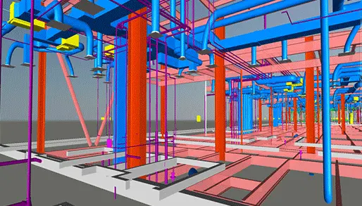
The Role of Navisworks in BIM Clash Detection
Navisworks is one of the maximum extensively-used BIM software answers for conflict detection. It is designed to combine fashions from unique disciplines (inclusive of architectural, structural, MEP) proper right into a single comprehensive 3D Model. Once the models are combined, Navisworks can identify and highlight potential clashes.
Key Benefits of BIM Clash Detection with Navisworks
- Early Identification of Issues: By figuring out clashes early in the design manner, production teams can take corrective motion before construction starts.
- Reduced Construction Costs: By keeping off high priced transform, BIM conflict detection can substantially reduce construction costs.
- Improved Project Schedule: By minimizing delays caused by construction mistakes, BIM clash detection can improve mission schedules.
- Enhanced Quality Control: By identifying and resolving potential troubles, BIM clash detection can improve the general quality of the development task.
BIM Clash Detection Services
Our BIM clash detection services include:
- Model Review and Coordination: We evaluation and coordinate BIM fashions from amazing disciplines to find out capability clashes.
- Clash Detection and Analysis: We use Navisworks to perceive and take a look at functionality clashes among one in every of a kind constructing systems.
- Clash Resolution: We paintings with design groups to treatment clashes and ensure that the layout is coordinated.
- Reporting and Documentation: We offer precise evaluations and documentation of all clashes and resolutions.
Why Choose Our BIM Clash Detection Services?
- Experienced Team: Our crew of skilled BIM experts has a deep information of BIM clash detection and Navisworks.
- Advanced Technology: We use the modern-day BIM software and technology to offer accurate and efficient conflict detection services.
- Customized Solutions: We tailor our services to fulfil the unique desires of every challenge.
- Cost-Effective Solutions: We provide charge-powerful solutions to help you shop money.
Conclusion
BIM Clash Detection with Navisworks is an vital provider which could redesign the manner construction tasks are achieved By identifying and resolving layout conflicts before production starts, Navisworks facilitates shop time, reduce prices, enhance collaboration, and make sure great effects. Whether you are running on a business building, industrial facility, or infrastructure project, leveraging Navisworks for conflict detection can save you luxurious on-web website mistakes, streamline workflows, and beautify the general achievement of your venture.
At Trisita Engineering LLP , we focus on presenting advanced BIM Clash Detection Services with Navisworks to make certain your initiatives run smoothly from start to complete. Contact us in recent times to discover how we permit you to optimize your subsequent project and avoid highly-priced mistakes with contemporary BIM era.

Architectural 3D Visualization: Revolutionizing the AEC Industry
One of the most inventive technologies in the contemporary world is Architectural 3D visualization and it is gaining popularity rapidly among professionals in the architecture, engineering and construction (AEC) industry. It helps create a comprehensive representation of the building design, internal spaces or a scheme of urban development through numerous graphic images. Such images present the major attributes of the object and serve as a good conception of the development of the building even before the construction work starts.
There has been an evolution in the architectural industry whereby 3D visualization has replaced the old architectural drafting. This change in the infrastructure is a very important improvement in architecture and construction processes. This radical change gives the authority to architects, designers and builders to construct real-life models of their thoughts hence making it easy to envisage and perfect a construction project.
What is the Architectural 3D visualization?
Architectural 3D visualization is the end product of a process in which very detailed and life-like three-dimensional models and renderings of the building designs are produced. Such models make it possible for architects, designers, and clients to focus on a virtual picture of a building or a room even before its actual construction. 3D visualization allows users to see and experience architectural design in the most realistic way as 2D drawings, blueprints or sketches are artistic impressions in computerized images and pictures as well as interactive motion sequences.
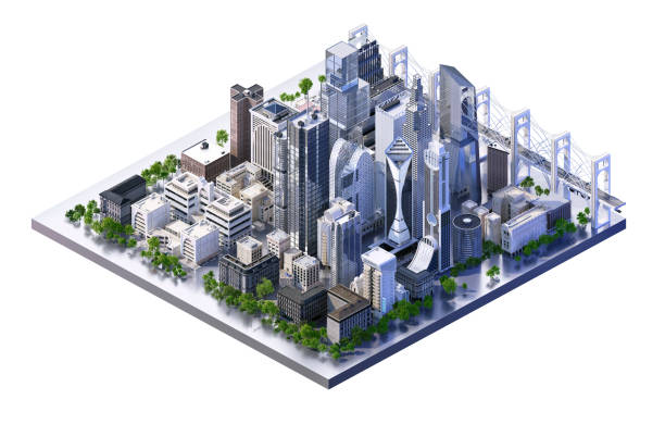
Types of Architectural 3D Visualization:
• Still rendering : The separate design views representing in high quality and static form and helpful in making presentations to the clients as well as marketing materials.
• 3D Walkthroughs and animations : Motion graphics which expose the clients to the depicted area or building space by virtually taking a walk through the particular structure or rotating around it.
• Virtual reality and Augmented reality : Merged and real experiences in which respective designs are presented to users in 3D space utilizing VR headsets or Augmented Reality applications on mobile gadgets.
• 360-Degree Views : Panoramas that can be rotated by users to move around a particular space, these are effective in creating experiences of a particular design.
Key Benefits of Architectural 3D Visualization
- Enhanced Client Communication:
- Clear and concise communication of design ideas
- Reduced misinterpretation of blueprints
- Increased client satisfaction and trust
- Informed Decision-Making:
- Early identification of potential design flaws
- Exploration of various design options
- Optimization of space utilization and functionality
- Marketing and Sales Tool:
- Create visually appealing marketing materials
- Attract potential buyers and investors
- Generate excitement and anticipation for upcoming projects
- Real-Time Collaboration:
- Facilitate efficient collaboration between team members
- Conduct virtual meetings and reviews
- Accelerate the design and approval process
Conclusion
Far from being a luxury, architectural 3D visualization is one of the critical elements in contemporary design practices. It helps in improving the quality of a project, client relations, and the actual construction of the projects for the future.
How can AEC IC Collection help you in business?
The AEC stands for Architecture, Engineering, and Construction collection and IC stands for Industry Collection. This superior collection provides designers, engineers, and contractors with a set of BIM and CAD tools. The collection is also supported by a cloud-based common data environment that facilitates project delivery from early-stage design through construction. The collection is very important for every architecture and engineer as they have all the supporting components for the successful completion of the project.
With AEC IC you get to do the following:
- You can create high-quality and high-performing buildings and infrastructure designs. You can perform all these with conceptual and detailed design tools.
- Get the chance to optimize your projects with integrated analysis, generative designs, and visualization and simulation tools.
- You can enhance the predictability in the field with tools that maximize constructability and project coordination.
- With us, you will get the experience of professionalism on your back that acts as a comforting cushion during backaches. Trisita has that comfortableness because we are into this for decades and know where can be the pitfalls.
Trisita also brings in affluent engineering and BIM services. The company is from the golden era and therefore knows what is the ultimate requirement of yours. What best than connecting with Gold Partner of Autodesk!
With AEC Collection, it’s easy to explore workflows by various industries:
-
Building design
Create more imaginatively and confidently Use a more fluid process to create conceptual designs. Architecture, structural Engineer and MEP Engineer have special collection tools to explore their design to work quick and better result.
- For Architecture, they can use Revit, Formit pro,3dsmax, AutoCAD, Autodesk Docs and Insight
- For Structure Engineer they can use Revit, Advance steel, Robot Structural Analysis professional and Navisworks
- MEP engineer they can use Revit, Navisworks and Fabrication CADmep
-
Infrastructure design
Establish collaborative practices across disciplines, co-ordinate horizontal design and vertical structures and drive more positive outcomes on transportation projects.
- For Transportation (Road and highway design) they can use AutoCAD, Revit Civil 3d, Recap pro, Infrawork
- Water infrastructure, Design water treatment plant piping and structures with connected drafting, modelling and analysis tools by using PLANT 3D and Infrawork
-
Construction
- General contractor: Material quantification, build reliable estimates and minimise material waste with precise quantification tools by using Revit and recap pro
- Mep contractor: Improve MEP project workflows using the streamlined design to fabrication capabilities in Revit and Fabrication CADmep coupled with powerful clash detection tools in Naviswork
- Structural contractor:Automate design to detailing to produce accurate shop deliverables that drive fabrication of concrete and steel structures with the help of Revit and advance steel
What consists of AEC IC?
The collection includes:
- Revit- It is a multidisciplinary software through which you can plan, design, construct and manage buildings.
- AutoCAD- This is software for 2D and 3D. It includes AutoCAD specialized toolsets and apps.
- Civil 3D– It is used for civil engineering design and construction of documentation software.
- Infraworks- It is analysis software designed conceptually for civil infrastructure.
- Navisworks Manage- It provides clash detection and advanced coordination, 5D analysis, and simulation software.
- Advance Steel- It is a 3D modeling software for steel detailing.
- ReCap Pro- It captures reality and is also a 3D scanning software.
- 3ds Max- It is a 3D modeling, animation, and software that is designed to render design visualization.
- Dynamo Studio- It helps create visual logic to design workflows and automate the tasks.
- Fabrication CADmep- It has MEP detailing and documentation software.
- Formlt Pro- It is an intuitive 3D sketching app with native Revit interoperability.
- Insight- It is software that builds performance analysis.
- Robot Structural Analysis Professional- The analysis has an advanced BIM integration structural analysis and code compliance verification tool.
- Structural Bridge Design- It is a structural bridge analysis software.
- Vehicle Tracking- It is a vehicle swept path analysis software.
- Autodesk Drive- It has CAD-aware cloud storage for individuals and small teams.
- Autodesk Rendering- It is fast, high-resolution renderings in the cloud.
AEC collection helps your business in:
AEC collection is the ultimate choice of most engineers and architects. This advanced collection will help your business in many diverse ways. Few ways are mentioned below:
- With this collection get access to more tools that enable you to bid for. The advanced support helps you stand in a winning position and deliver more business.
- Helps you deliver high-quality building and infrastructure projects that can exceed the performance requirements.
- This package helps you improve operational efficiency by providing automated tasks. With the help of automation, the task relating to design time is reduced and thereby improves handoff with streamlined data exchange.
- The project predictability is highly increased. There has been increasing in stakeholder buy-in and a reduction in errors and rework.
Why choose Trisita?
Trisita has been in existence for decades. We exactly know what area creates problems and we are very must be accustomed to the importance of time and productivity ratio. The initiative is extensively engaged in myriad solutions.
We believe greatly in discipline and good communication therefore we are confident in what we are providing to you. Considering the pandemic situation and your availability, we had planted an e-commerce mode for your easy purchases.
Some of the perks of choosing Trisita are listed below:
- Our main concern is to compress your hard work with digital and innovative solutions.
- Trisita is the Gold Partner of Autodesk and this plays the most loyal role in the Autodesk field.
- We strive for perfection therefore with us you will get the opportunity of paid training.
- With us get your free trial.
- Considering the time spent in this industry, you will get the most professional and experienced service.
- The company has an awarding history with an impeccable client base.
- Current maintenance prices will experience a 20% price increase on renewals after 7 August 2020.
Check out Trisita’s all other blogs at our official blog page.
Get your AEC IC Collection now at great discount from our newly launched Ecommerce Store at https://trisita.co.in/online-shopping/.


